


このアプリのYoutube動画がある場合はURLを送信してください。詳細 »
APPLICATION INFO - iPhoneアプリの詳細情報
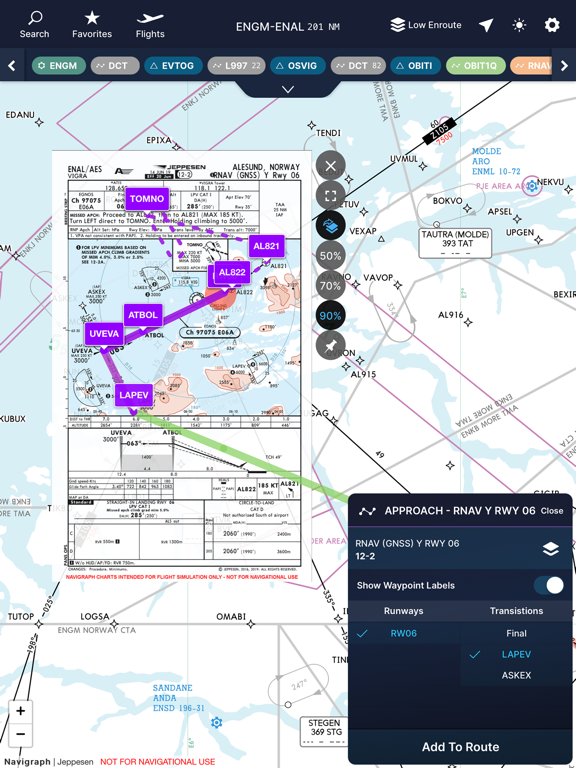
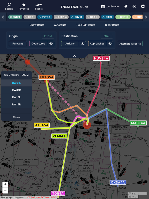
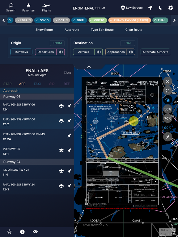
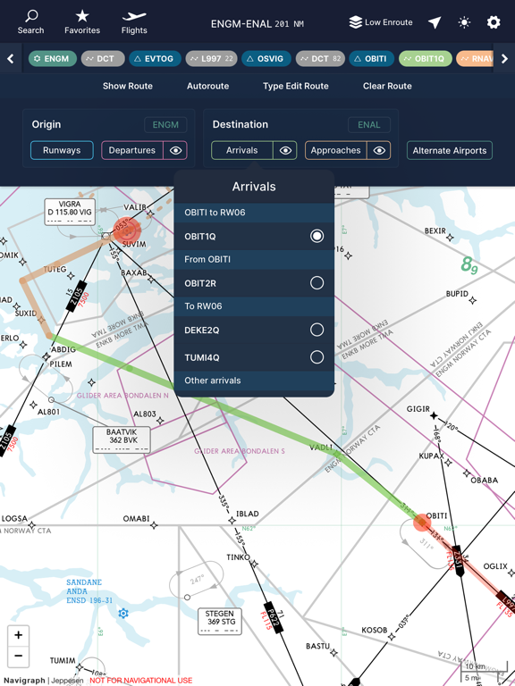
Navigraph Charts is the easy way for flight simulator enthusiasts to search, view and organize IFR airport and enroute charts. The charts are provided by Jeppesen and cover over 6,800 airports worldwide and are always up-to-date.
You will experience the following with Navigraph Charts App:
- Worldwide and current Jeppesen IFR charts: 6,800+ airports covered
- Moving maps: showing your simulator's aircraft position on the charts in real time
- Night mode: Dark theme version of the charts for low ambient light conditions
- Flight organization: Collect charts for departure, destination and alternates in a single place
- Chart color coding and pinboards: Easily filter specific chart types and pin charts for quick access
- Interactive enroute charts: Click and search airports, waypoints, navaids, airways, controlled and restricted airspaces, FIRs/UIRs, holding patterns and more
- Route visualization: Show your flights route on the enroute charts
You must be a Navigraph user subscribing to Navigraph Charts for full access to this application. If you're not a subscriber yet, you may login to view demo airports Alicante, Spain (LEAL) and Ontario, CA, US (KONT).
An active Internet connection is required when using the app - no offline mode.
NOT FOR REAL WORLD NAVIGATION - FOR FLIGHT SIMULATION USE ONLY
※iPadでご利用できるアプリです。
▼現在のバージョンの平均評価
 51件の評価
51件の評価
▼すべてのバージョンの平均評価
51件の評価
51件の評価
カテゴリー
ナビゲーション
ナビゲーション
リリース
2015/6/11
2015/6/11
更新
2017/12/15
2017/12/15
バージョン
2.0.7
2.0.7
言語
サイズ
41.2 MB
41.2 MB
条件
このバージョンの新機能
- Improves moving maps accuracy in charts
- Stability and bug fixes
- Improves moving maps accuracy in charts
- Stability and bug fixes
スクリーンショット
» 目的別iPhoneアプリ検索
- 辞書 » 日本語対応の辞書 » 英和辞典
- 学習 » 英単語 » 英会話 » クイズで楽しく
- スケジュール » 管理 » Googleカレンダー


CatchApp新着アプリレビュー
 日本縦断てつどうの旅」")
様々な楽しみ方で運転士として成長していく鉄道運転士育成RPG「プラチナ・トレイン(プラトレ) 日本縦断てつどうの旅」
2016-05-17 00:00

日本語にはない英語発音のリスニングを楽しく学べる「発音どっち?英語リスニング 」
2014-12-20 12:00

指先の瞬発力が試されるカジュアルゲーム「早撃ちパニック」をリリース!
2014-12-08 15:21
新着アプリ動画
-
 ¥1500
¥1500

-
 ¥600
¥600
-
 ¥3000
¥3000